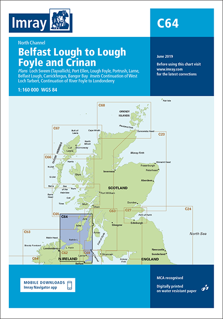
Skip to product information
1 of 1

Imray

Imray Chart C64 Belfast Lough to Lough Foyle and Crinan

Regular price
£23.95
Regular price
Sale price
£23.95

Imray Chart C64 Belfast Lough to Lough Foyle and Crinan, March 2022, features detailed cartography based on the latest official surveys, WGS 84 datum, offers clear colour-coded definitions of shallow & drying areas, plus large-scale plans of harbours. On-chart, tidal stream data follows the Admiralty's "diamond" pattern, as well as standard tidal constants. Most charts also feature tidal stream diagrams and information on radio services. For sailors, where applicable, useful phone numbers & facilities are conveniently included. On the reverse of the chart, signs, symbols, abbreviations & general info about tides, weather, and foreign terms are featured.

Plans included:

  • Loch Sween (Tayvallich) (1:25 000)
  • Continuation of West Loch Tarbert (1:65 000)
  • Port Ellen (1:25 000)
  • Lough Foyle (1:90 000)
  • Portrush (1:20 000)
  • Larne (1:18 500)
  • Belfast Lough (1:110 000)
  • Carrickfergus (1:15 000)
  • Bangor Bay (1:17 500)
  • Continuation of River Foyle to Londonderry (1:60 000)


On this edition the latest depth surveys have been applied along with general updating throughout.

Imray Chart C64 Belfast Lough to Lough Foyle and Crinan