Skip to product information
1 of 2

Imray

Imray Chart C52 Cardigan Bay to Liverpool

Regular price
£25.95
Regular price
Sale price
£25.95
About

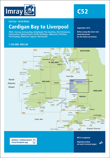
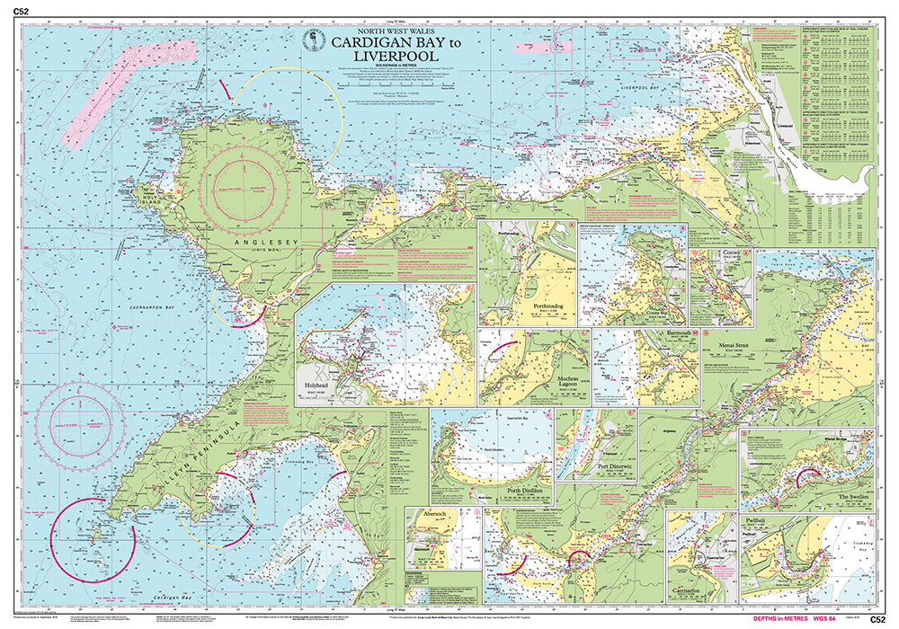
Imray Chart C52 Cardigan Bay to Liverpool, corrected to February 2024, features detailed cartography digitally printed on water resistant paper and is presented in a clear plastic wallet. It is designed to be used alongside Cruising Anglesey and adjoining waters and the Irish Sea Pilot.

Version control: can be updated as appropriate with the relevant Correction Notice which is downloadable from Imray website using QR code on the rear of the chart folder or website link.

Features Overview
    • Updated to include latest UKHO data combined with additional information to make it suitable for small craft use
    • Sheet size 787 x 1118mm
    • Chart has been fully revised throughout
    • Includes charting and tidal data for passage, approach and mooring
    • Harbour plan of Holyhead has been reschemed at an amended scale of 1:27 500
    Chart/Insets included
    • Conwy (1:30 000)
    • Conwy Bay (1:60 000)
    • Holyhead (1:27 500)
    • The Swellies (1:15 000)
    • Port Dinorwic (1:15 000)
    • Caernarfon (1:15 000)
    • Menai Strait (1:60 000)
    • Porth Dinlläen (1:17 500)
    • Abersoch (1:15 000)
    • Pwllheli (1:15 000)
    • Porthmadog (1:10 000)
    • Mochras Lagoon (1:15 000)
    • Barmouth (1:30 000)

    Imray Chart C52 Cardigan Bay to LiverpoolImray Chart C52 Cardigan Bay to Liverpool