1
/
of
1
Imray
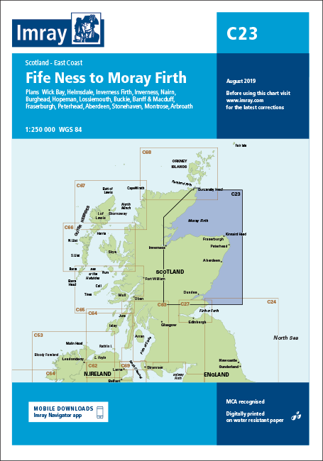
Imray Chart C23 Fife Ness to Moray Firth, 2022 Edition
Imray Chart C23 Fife Ness to Moray Firth, 2022 Edition
Regular price
£18.00
Sale price
£18.00
Regular price
£23.95
Unit price
/
per
Next Day Delivery Order in the next
0h
0m
0s
Delivery Next day delivery available
Same Day Dispatch Order before 11am
Free Collection from our boat yard. Usually available within 24 hours

About
Features Overview
Charts/Insets included
Features Overview
Imray Chart C23 Fife Ness to Moray Firth, Edition corrected to February 2022, features detailed cartography based on the latest official surveys to WGS 84 datum. The chart is digitally printed on water resistant paper and is presented in a clear plastic wallet with supporting information.
Version control: can be updated to July 2023 edition with the relevant Correction Notice which is downloadable from Imray website using QR code on the rear of the chart folder or website link.
Charts/Insets included
- Clear colour-coded definitions of shallow and drying areas, plus large-scale plans of harbours
- On-chart, tidal stream data follows the Admiralty's "diamond" pattern, as well as standard tidal constants
- Useful phone numbers, radio frequencies and general information included for most harbour facilities
- Includes a separate sheet of signs, symbols and abbreviations used on the chart
- Fife Ness to Moray Firth (1:250 000)
- Wick Bay (1:10 000)
- Helmsdale (1:10 000)
- Inverness Firth (1:75 000)
- Nairn (1:7 500)
- Burghead (1:8 000)
- Hopeman (1:7 500)
- Lossiemouth (1:7 500)
- Buckie (1:15 000)
- Banff & Macduff (1:25 000)
- Fraserburgh (1:7 500)
- Peterhead (1:17 500)
- Aberdeen (1:20 000)
- Stonehaven (1:17 500)
- Montrose (1:12 500)
- Arbroath (1:15 000)
- Inverness (1:25 000)


